Tuesday, May 31, 2011

Race Report: 2011 11K Paris Mountain Trail Race

Results (based on Guntime):
1h 26m 56s
Overall 170/216


Instead of handing out t-shirts, they gave out patches this time.
Visors next time, please! ;-)
Pre-Race:
They ran a special on this race at the day of the Green Valley Road Race, so I was able to sign up for 10 bucks... SWEET. Coming off Mt Mitchell training and "racing" with a streak of bad runs... Not quite so sweet. But since I was signed up, I would suck it up and do it anyways... But easy! While it was a race, I was not feeling it and so, I would just treat it like a nice trail outing with 200 of my closest friends.

Got up at around 6am, had a small breakfast and we headed out the door at a little to 7am. Paris Mountain State Park is close to the house, so that's always good. Once we were there, picked up our numbers and our patch and good our stuff together. While Terry used the time for a short warm-up, I was yapping the time away by talking to my running friends. Actually, I was still yapping when everyone else all of a sudden started running... Oops.


Thanks Flemming for the pics!
Race:
It was pretty much the usual for me on these races, this was my third time doing this particular distance of the trail running series, but they switched the 11K now to May, while it used to be in November. I actually prefer having the 15K distance in November in the future, so all is good. Nevertheless, the conditions were miserable... hot and humid. After two days of rain, the temps hardly cooled, so it once again felt like running in a steam sauna.

I started out easy in the paved section and then just held on for dear life to stay with the group that I was in for the next mile or so. Once my body warmed up, I was able to push it a little more and pass a couple of people, got passed by some other people and leapfrogged with some. I didn't want to walk until I hit the first lake and traffic was backing up at the steps anyways so I had to slow down... Which I welcomed very much. The dizziness that set in right after slowing down didn't feel to great and I just pushed myself to keep on moving, because I know from past experience, if I stop once I am dizzy, I am toast... So while I was dragging my butt up the steps and down the other side, I tried to get as much water (thanks race vest) as possible into me to try to recover. As usual, I spend a lot of mile three walking. It's the death march up Sulphur and no matter how often you do this climb, it just doesn't get better.... yay to a 20 minute split! ;-) Once on Firetower trail, I started running again and soon got to chat with the two runners in the picture above. We stuck together for a little while, before I stopped to hose off another runner that took a spill (thanks race vest).  Kanuga and Brissy Ridge is sort of a rolling trail and I kept on taking frequent walk breaks on the uphills and ran the downhills and flats. I was glad when we got to the upper parking lot... Just one really steep short left and then it's sorta downhill from there. First it's a very steep (quad and knee busting) downhill and then there are a little rollers all the way to the finish. I made myself run the rest of the race, even though I wasn't feeling it... I really do have pacing issues a lot, so I allowed myself to slow down, but didn't allow myself to walk.

One side note: Never be fooled by girls in pink running skirts! A girl was passing me on the last steep hill and she blasted down that really steep section. It took two switchbacks and I never saw her again. That was pretty amazing to see!

About to finish!

Post Race:
I was greeted at the finish line by my husband, who finished 20 minutes ahead of me (what's new) and some relay team goons. Grabbed a bagel and waited on the final goon to arrive before heading back home. Once I had a cell phone signal, I checked my race page from the past, to see how I did compared to previous years and was surprised and happy, that I was just two minutes slower this time around... Despite heat/ humidity and hardly any running lately. I'll take it.


Monday, May 30, 2011

USA Cycling Pro Road Championship - Spectator Video

The USA Cycling Pro Championships were in town this weekend again.

Last night, I saw an e-mail, that they were still looking for volunteers and so I decided to sign up for a spot on the course today. I ended up on the intersection of Altamont Road and View Point Road and had a blast.... even though, I just saw the cyclists for a couple of minutes each loop.

And here is the video for your viewing pleasure:


Sunday, May 29, 2011

Yoga Bikemute


For today, I had grand plans of some sort of longer bike ride, but then I woke up with a stiff neck and decided to do some yoga instead.

Still wanted to ride the bike a little bit and so I ended up riding to YMCA and back home. Round trip was around 18 miles at a very easy pace on the hybrid. I just enjoyed being outside!

The yoga worked some of the kinks out of my neck.... It feels better, but it's not good yet. Silly neck these days.

Here are some pictures from my ride back home.


Parking for the hybrid.

Yes, I am wearing flip flops and I have the Garmin on the bike.

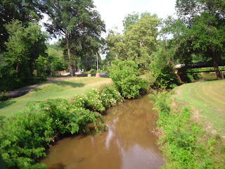
Creek in Cleveland Park.

Follow the rabbit.

Redone bridge in Cleveland Park.

The Reedy River.

Smile! ;-)

Another shot of the Reedy.

Memorial in Cleveland Park.

Word Art.

Liberty Bridge - Never gets old.

River Falls Park.

Wall Art.

Liberty Bridge from below.

Swamp Rabbit Trail.

More Trail.

More smiles.


Saturday, May 28, 2011

SPOT Satellite GPS Messenger Review


If you are a regular reader, you know that I have been out cycling a lot over the last couple of months. I tried to put in my long rides in the company of my trainer partners, but that didn't always work out. Most of the time, I try not to think about, what could possibly happen to me while out on the bike, but I am not acting completely stupid either and normally have my Road I.D., a cell phone and some pepper spray with me. The most important thing for me to have on me is my cell phone, but once you are up in the mountains, you can pretty much forget about reception. And if I would really spill one day and would lay in a ditch, who knows, when the next car comes by to find me and put that Road I.D. on my wrist to good use.

A couple of weeks ago, I read a post over at DC Rainmaker (if you like gadgets that come with our sport, this is the blog to read!) about the Garmin GTU10 satellite GPS tracker. I don't think, I ever heard about satellite GPS trackers and if I did, I don't think I would have thought that would be something useful for me before the whole preparation for AOMM.

After doing some research in the field and reading several reviews, I actually didn't end up buying the Garmin tracker (even though, I normally do love all things Garmin), but went with the SPOT Satellite GPS Messenger instead. The reason for it was mostly the price point for me and that the SPOT unit communicates with search and rescue in emergencies (I still have that Appalachian Trail hike in the back of my head... One of these days...) and lets you send messages to a customized user list.

I got the "adventure kit" version from REI (currently not available on their website) and the package included: 

  
  • 15 percent Discount code off SPOT Basic Service activation
  • Form-fitting SPOT Messenger Flotation Case
  • Micro PICO(TM) Lite LED Flashlight by eGear
  • Safety Whistle
  • Carabiner Keychain
  • Durable Lanyard 
  • Case with Arm Strap
  • SPOT Safety Tips Bandana 

Obviously, this is made for the real adventurer and maybe, at one point, I will be able to utilize this, but usually, I am not that far away from the beaten path.

The unit itself is the size of my palm and pretty light weight. It is powered by two lithium batteries and according to the manual, the battery life is pretty darn long. I can't say anything about this quite yet.


According to this map it has reception pretty much all over the world.... Of course, so far, I don't have much experience with this, but during my Mount Mitchell ride, I had reception for the most part. The only time, where the unit had some trouble was the tree covered section on Hwy 80.


Now for the functions: The unit has six buttons (easy enough) and I am just copied the description from the official website since I could hardly explain it better.


icon
SOS: Use this function In the event of a life threatening or other critical emergency to notify emergency services of your GPS location and that you need assistance. The GEOS International Emergency Response Center alerts the appropriate agencies worldwide – for example contacting 9-1-1 responders in North America and 1-1-2 responders in Europe.
Read more

icon
Help: In the event of a non-life threatening emergency, you can use this function to notify your personal contacts that you need assistance. Additional SPOT Assist services can be purchased and programmed to your Help button as well. When activated with SPOT Assist, the Help button will notify professional services either on the land or water. SPOT has partnered with national service providers to offer non-life threatening assistance.
Read more

icon
Check-in/OK: This feature allows you to let your friends and family know that all is OK with a pre-programmed message along with your GPS location. With a push of a button a message is sent via email or SMS to up to 10 pre-determined contacts and your waypoint is stored in your SPOT account for later reference. Your stored waypoints can be easily integrated into a SPOT Shared Page or SPOT Adventure account.
Read more

icon
Custom Message: This feature allows you to let your friends and family now receive a custom message along with your GPS location with a push of a button. Use this feature as a secondary OK message or transfer your personal help alert to this message function if you are using a SPOT Assist service on your Help button.
Read more

icon
Track Progress: This feature allows you to send and save your location and allow contacts to track your progress in near real time using Google Maps. With your SPOT account you have the ability to set up a SPOT Shared Page which allows you to show your SPOT GPS locations to others on a Google Map.
Read more


Once you get the SPOT in the mail, it has to be set-up first. In order to work, you have to buy a basic service package (for which there is a discount card in the adventure kit) in order to use the functions like the messaging to your contacts and S.O.S. To be able to use the tracking feature, you have to pay another yearly fee. I added the tracking feature, because this way it is possible for others to locate me (even if I don't send a message) by checking my shared page, that I set-up previously.

While getting the unit activated was a quick and easy process, customizing the contacts and the shared page is not very intuitive in my opinion, but eventually I managed to get it done. 


This is a screen shot of my shared page with the last 30 miles of AOMM. When you click on the picture to enlarge it, you can see, that the tracking doesn't follow to the road, but connects each submitted location directly. You also see the long straight shot from Marion up to the intersection Hwy 80 and Blue Ridge Parkway during which the Spot didn't get a signal due to the trees. I guess, if I had stopped for a little at a spot with less trees, it wouldn't have been an issue to get a quick signal for another location submission.


And if you have a closer look at my AOMM finisher pic, you can see the SPOT strapped to my bottle cage that is mounted on the seat post. I had one little scare, when the case slipped off the bottle cage and the SPOT was only hanging on the lanyard, but fortunately we noticed it and I had a rubber band (what are the odds) with me, so I was able to secure it better.

Overall, I am happy with this purchase so far, even though I didn't have a ton of chances to try it out. It'll certainly will be my companion for future rides, especially the ones that I do alone. Just a little piece of mind for me and the hubs.


Friday, May 27, 2011

Open Water Swim and Sauna Run


In two weeks, I will participate in my first swimming only event ever. I am signed up for the 3K race at the 17th Annual Death Valley Open Water Swim Meet in Lake Hartwell, Clemson SC.

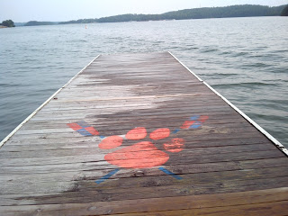
Dock for the Rowing Club on East Beach Lake Hartwell

I haven't done any swimming in open water since doing a sprint tri last August. So last Wednesday, I ducked out of work a little early and made the drive down to Clemson to take advantage of the open water swim, that takes place on the East Beach every Wednesday night.

East Beach Lake Hartwell
You won't see any people on the pictures, because I took them once I was done with my run, so you just have to believe me here: There was a good amount of people out for the swim. They officially have two waves (5:30pm and 6:15pm), but it seemed like everyone just got in the water whenever. I got there late (despite getting out of work early, it's just quite a haul from Duncan to Clemson) and most people were already in the water, but a small group just got there around the same time, so I headed out with them.... After one girl from the group gave me a couple of pointers (line to choose, the different buoys, watch for people coming back in, the kayakers etc), since this was my first time swimming there.

View from East Beach
The goal was to get to the furthest buoy which was supposed to be between 1 and 1.2 miles out and back. I am claiming that my swim ended up being 1.2 miles, because my line was not a line but a lot of zigzag. My sighting was bad and I had some goggle trouble and swallowed some lake water at the beginning, but after that, I got into a nice groove and was able to handle the slight chop without too many upsets.


One of these days, I will put together a post about "how to not freak out in the open water" with strategies that I seemed to use each time I am out there. Given, that I can still count all my open water swims on two hands.

Car = Transition Zone

After I got out of the water, somebody told me that they normally go to Mellow Mushroom after the swim... That sounded great, but I had a 4-miler on tap, so I put on my shoes and headed out right away.

As you see, I brought my wetsuit, but the water was like a bathtub (that's says much coming from me) and I am glad that I decided against putting in on, otherwise I would have been very uncomfortable.


From the parking lot it was a straight shot on a grass trail right along the lake for a while, that turned into a paved trail after that.


After a little over a mile, the trail was done, so I just added another mile by making a couple of random turns.


After I hit the second mile, I turned around to retrace my steps.


It was hot and humid that evening and I had a miserable run.


I guess, it's going to take me another couple of weeks until I am used to these kind of conditions again.... Or, I just have to get my butt out of bed earlier and avoid sauna running as much as possible.
Clemson Football Stadium

It was quite a drive from work to Clemson and then back home, but I am glad I had the chance to do this. I feel a little better about that 3K swim coming up and running in a new (to me) place with something new to look at is eventually still fun, no matter how hot and humid it is.


Thursday, May 26, 2011

Mark Your Calendars! 5-26-2011


5/28
Wheel Ride For Food
All rides start (8:30am) and finish at Carrier Park in Asheville NC during the Mountain Sports Festival.
Metric Century/ Metric Half-Century and Full Century Road Ride to benefit Meals on Wheels of Asheville-Buncombe County.

5/28
Piranha River Run 5K/ Walk @ 8:30am, Kids fun run to immediately follow
help support the Pelham Falls Swim Team
Where: Pelhams Falls subdivision Batesville RD, near Highway 14 at the clubhouse. Park at Guardian across the street. Cost 25$ per family or 10$ per person.
The online registration for this event looks to be closed already, but the RD info is on that webpage.


5/28
Lowcountry Splash Open Water Swim
Start Location: Hobcaw Yacht Club, Charleston SC
Distance: 2.4 miles

5/28
Freedom Weekend Aloft
5K Run/Walk @8AM

5/28 and 5/30
USA Cycling National Championships, Professional Road and TT
All events are free to the public.
5/28 Individual Time Trial Championships CU-ICAR, 11:30am
5/30 Road Race Championships Downtown Greenville, 11:00am

5/29
Stars and Stripes Challenge
Gateway Park, Travelers Rest SC, Mass Start 7:30am
Fully supported ride options: 10, 30, 62 and 100 miles

6/4
Safe Harbor Cycle Tour, 8.30am in Iva SC
25 and 65 mile ride options. $40 if registered by May 15.

 6/5
Fletcher Flyer
Venue: Fletcher Community Park near Asheville NC
Routes: 100, 62, 50 and 30 miles

6/11
Rail Trail 5K
- Beginning at the East Henry Street Trailhead in Spartanburg SC
8:00am registration and packet pick-up, 9:00am race start

6/11
17th Annual Death Valley Open Water Swim Meet
East Beach on Hartwell Lake, Clemson University, Clemson SC
Distances: 5K, 3K, 2K, 1K, ½K

6/26
The Ridges Resort Invitational 5k Open Water Swim
Location: Hiawassee, GA


7/9 and 8/6
Hilton Head Island Beach Bum Triathlon
Start Time: 8am
Race Location: Coligny Beach, Hilton Head Island.
Race Format: 500m Ocean Swim / 6mi Beach Bike / 3mi Beach Run.


7/15-7/17
A Ride to Remember

8/27
Hickory Nut Gorge Olympiad VII (1-mile, 2-mile)
Location: Lake Lure, NC

9/10
Setting the Pace at Whitten Center 10K and 5K Run/Walk at 8:30 a.m.
Clinton, SC
Entry $25 before August 26th. Late entry is $30.

9/17
Kings Mountain/Moss Lake Open Water Swim
Distances: 5K, 3K, 2k, 1k, and 500m
Website, once it's availble

10/8
iRecycle Run Half Marathon and 5K
in Spartanburg
click here for registration


10/15
Bluffton SC Half Marathon and 5K

********************

Greenville Track Club Paris Mountain Trail Run Series

5/28 - 11K
8/13 - 7K
11/5 - 15K


The Y Tri Series:

06/18 – Ft Mill, SC
07/16 – Columbia, SC
07/31 –Blacksburg, SC
08/27 – Toccoa, GA
09/10 – Surf City Beach, NC
09/17 – Hartsville, SC
For more information (pricing, distances, if duathlon event is available etc) check the website.

Other YMCA Tri/Du Events:

6/4 Middle Tyger YMCA
8/ 6 Union County YMCA
8/ 13 Laurens Family YMCA
9/ 24 Tri the Ridge Pickens County YMCA


2011 XTERRA South Carolina Trail Run Series

7/10 Harbison Half Marathon (Columbia)
8/? Table Rock 15K

********************

GROUP RUNS organized by the Greenville Track Club

* Tempo Runs at Mauldin Middle School every Monday night at 6:30pm
* Track Workouts at Greenville High Track every Wednesday night at 6:00pm

ON THURSDAYS

"Girl's Morning Out" at Carolina Triathlon in downtown Greenville. Gather at 8:45am to pedal promptly at 9am. This is a 30-mile "C" ride hosted every Thursday by GHS EveryWoman Cycling Team and Carolina Triathlon. Road bikes and helmets are required. Everyone is welcome and nobody is left behind.

Normally gets canceled, if rain is in the forecast.